
Lewis and Clark Expedition, (1804–06), U.S. military expedition, led by Capt. Meriwether Lewis and Lieut. William Clark, to explore the Louisiana Purchase and the Pacific Northwest. The expedition was a major chapter in the history of American exploration.
Contents [hide]
Lewis and Clark Expedition
The Lewis and Clark Expedition, also known as the Corps of Discovery Expedition, was the United States expedition to cross the newly acquired western portion of the country after the Louisiana Purchase. The Corps of Discovery was a select group of U.S. Army and civilian volunteers under the command of Captain Meriwether Lewis and his close friend Second Lieutenant William Clark. Clark, along with 30 others, set out from Camp Dubois (Camp Wood), Illinois, on May 14, 1804, met Lewis and ten other members of the group in St. Charles, Missouri, then went up the Missouri River. The expedition crossed the Continental Divide of the Americas near the Lemhi Pass, eventually coming to the Columbia River, and the Pacific Ocean in 1805. The return voyage began on March 23, 1806, at Fort Clatsop, Oregon, ending six months later on September 23 of that year.
President Thomas Jefferson commissioned the expedition, shortly after the Louisiana Purchase of 1803, to explore and detail as much of the new territory as possible. Furthermore, he wished to find a practical travel route across the western half of the continent—directly avoiding the hot and desolate desert southwest—and to establish an American presence in the new lands before European powers attempted to establish claims of their own. The campaign’s secondary objectives were scientific, economical and humanitarian, i.e., to document the West’s biodiversity, topography and geography and to establish positive trade relations with (potentially unknown) Native American tribes. The expedition returned to St. Louis to report their findings to President Jefferson via maps, sketches, and various journals.
Commissioning and preparation
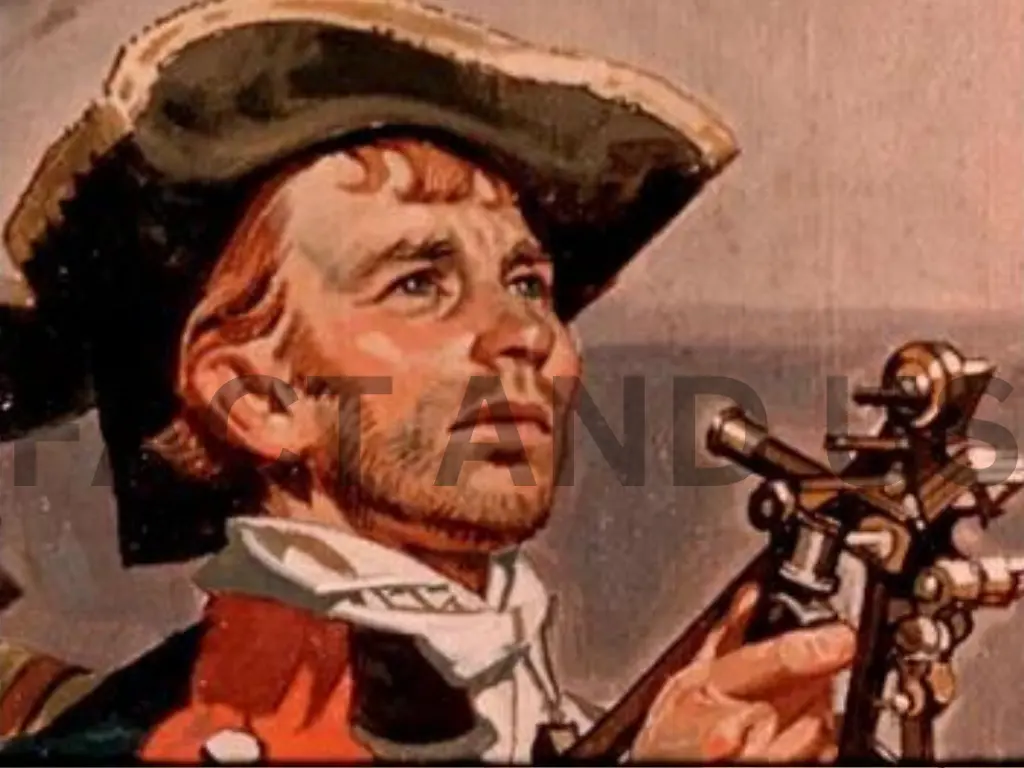
On January 18, 1803, U.S. Pres. Thomas Jefferson sent a secret message to Congress asking for $2,500 to send an officer and a dozen soldiers to explore the Missouri River, make diplomatic contact with Indians, expand the American fur trade, and locate the Northwest Passage (the much-sought-after hypothetical northwestern water route to the Pacific Ocean). The proposed trip took on added significance on May 2, when the United States agreed to the Louisiana Purchase—Napoleon’s sale of 828,000 square miles (2,100,000 square km) of French territory for $27 million. Jefferson, who had already sponsored several attempts to explore the West, asked his personal secretary, Meriwether Lewis, to lead the expedition. Lewis was dispatched to Philadelphia for instruction in botany, celestial navigation, medicine, and zoology. He also purchased supplies and spent $20 on a Newfoundland dog, Seaman.Lewis procured weapons at Harpers Ferry, Virginia (now in West Virginia), supervised the construction of a 55-foot (17-metre) keelboat, and secured smaller vessels, in addition to designing an iron-framed boat that could be assembled on the journey. As his co-commander he selected William Clark, who had been his military superior during the government’s battles with the Northwest Indian Federation in the early 1790s. The U.S. secretary of war denied Lewis’s request of a shared command, but Captain Lewis and Lieutenant Clark chose to address one another as “captain” to hide this fact from the other members of the expedition. For his part, Clark recruited men in Kentucky, oversaw their training that winter at Camp River Dubois in Illinois, and served as the expedition’s principal waterman and cartographer.
Expedition from May 14, 1804, to October 16, 1805
Over the duration of the trip, from May 14, 1804, to September 23, 1806, from St. Louis, Missouri, to the Pacific Ocean and back, the Corps of Discovery, as the expedition company was called, traveled nearly 8,000 miles (13,000 km). The entourage, numbering about four dozen men, covered 10 to 20 miles (16 to 32 km) a day—poling, pushing, and pulling their 10-ton keelboat and two pirogues (dugout boats) up the Missouri River. Lewis’s iron-framed boat was later assembled and covered with skins near Great Falls (in present-day Montana) but had to be abandoned because the seams leaked and there was no pitch to seal them. The captains and at least five others kept journals. President Jefferson had instructed Lewis to make observations of latitude and longitude and to take detailed notes about the soil, climate, animals, plants, and native peoples. Lewis identified 178 plants new to science, including bitterroot, prairie sagebrush, Douglas fir, and ponderosa pine, as well as 122 animals, such as grizzly bear, prairie dog, and pronghorn antelope. The scientific names Philadelphus Lewisia (mock orange), Lewisia redrive (bitterroot), and Clarkia Pacella (pink fairy, or ragged robin) are but three examples of the men’s discoveries. The expedition encountered immense animal herds and ate well, consuming one buffalo, two elk, or four deer per day, supplemented by roots, berries, and fish. They named geographic locations after expedition members, peers, loved ones, and even their dog (Seaman’s Creek). They experienced dysentery, venereal disease, boils, tick bites, and injuries from prickly pear, yet only one man perished over the course of the journey.
The expedition arrived at the Mandan and Hidatsa villages near present-day Bismarck, North Dakota, and constructed Fort Mandan in which to spend the winter. The captains prepared maps, artifacts, mineral samples, plant specimens, and papers to send back in the spring. On April 7, 1805, a small crew departed on a St. Louis-bound keelboat laden with boxes of materials for Jefferson that included live magpies and a prairie dog. Meanwhile, the permanent party proceeded up the Missouri in six canoes and two pirogues. It now consisted of 33 people, including soldiers, civilians, Clark’s slave York, and two newly hired interpreters—a French Canadian, Toussaint Charbonneau, and his Shoshone wife, Sacagawea, who had given birth to a boy, Jean Baptiste, that February. The departure scene was described by Lewis in his journal.
Journey Departure
The Corps of Discovery departed from Camp Dubois (Camp Wood) at 4 pm on May 14, 1804. Under Clark’s command, they traveled up the Missouri River in their keelboat and two pirogues to St. Charles, Missouri where Lewis joined them six days later. The expedition set out the next afternoon, May 21. While accounts vary, it is believed the Corps had as many as 45 members, including the officers, enlisted military personnel, civilian volunteers, and York, an African-American man enslaved by Clark. From St. Charles, the expedition followed the Missouri through what is now Kansas City, Missouri, and Omaha, Nebraska. On August 20, 1804, Sergeant Charles Floyd died, apparently from acute appendicitis. He had been among the first to sign up with the Corps of Discovery and was the only member to die during the expedition. He was buried at a bluff by the river, now named after him, in what is now Sioux City, Iowa. His burial site was marked with a cedar post on which was inscribed his name and day of death. 1 mile (2 km) up the river, the expedition camped at a small river which they named Floyd’s River. During the final week of August, Lewis and Clark reached the edge of the Great Plains, a place abounding with elk, deer, bison, pronghorn and beavers.
The Lewis and Clark Expedition established relations with two dozen Native American nations, without whose help the group would have risked starvation during the harsh winters and/or become hopelessly lost in the vast ranges of the Rocky Mountains. They followed the Missouri to its headwaters, and over the Continental Divide at Lemhi Pass, then north to Traveler’s Rest, and crossed the Bitterroots at Lolo Pass. They descended on foot, then proceeded in canoes down the Clearwater, Snake, and Columbia rivers, past Celilo Falls and present-day Portland, at the confluence of the Willamette and Columbia rivers. Lewis and Clark used William Robert Broughton’s 1792 notes and maps to orient themselves once they reached the lower Columbia River. The sighting of Mount Hood and other stratovolcanoes confirmed that the expedition had almost reached the Pacific Ocean.
Pacific Ocean
The expedition sighted the Pacific Ocean for the first time on November 7, 1805, arriving two weeks later. The expedition faced its second bitter winter camped on the north side of the Columbia River, in a storm-wracked area. Lack of food was a major factor. The elk, the party’s main source of food, had retreated from their usual haunts into the mountains, and the party was now too poor to purchase enough food from neighboring tribes. On November 24, 1805, the majority of the party voted to move their camp to the south side of the Columbia River near modern Astoria, Oregon. Both Sacagawea and the enslaved York participated in the vote.
On the south side of the Columbia River, 2 miles (3 km) upstream on the west side of the Netul River (now Lewis and Clark River), they constructed Fort Clatsop. They did this not just for shelter and protection, but also to officially establish the American presence there, with the American flag flying over the fort. During the winter at Fort Clatsop, Lewis committed himself to writing. He filled many pages of his journals with valuable knowledge, mostly about botany, because of the abundant growth and forests that covered that part of the continent. The health of the men also became a problem, with many suffering from colds and influenza. A Russian maritime expedition under statesman Nikolai Romanov arrived at the mouth of the Columbia River while Lewis and Clark were still there. Neither Romanov nor Lewis and Clark knew about each other. Romanov had come from Novo-Arkhangelsk (today Sitka, Alaska), intending to establish a Russian agricultural colony to help with the perennial food shortages in Russian America, and made plans for a relocation of the capital of Russian America from Sitka to the lower Columbia River. But his ship, Juno, was unable to cross the Columbia Bar. So Romanov went to California instead, setting in motion a process that eventually led to the founding of Fort Ross, California
Pacific Ocean and Return
They finally arrived at the Pacific Ocean in mid-November, with Clark recording in his journal, “Ocian in view! O! the joy.” Fierce storms delayed their progress for nearly a month. The members conducted a democratic vote on where to spend the winter, with even York and Sacagawea casting votes. Near present-day Astoria, Oregon, the corps built Fort Clatsop and endured a wet, miserable winter by journal writing, drying meat, making salt, and traveling to see a beached whale. They hoped to encounter vessels along the Pacific that could transport them home, but, finding none, they did an about-face, planning to return along the Columbia and Missouri rivers. After stealing a Clatsop Indian canoe, they headed up the Columbia on March 23, 1806. They arrived at the Nez Percé villages, gathered up their horses, and waited for the snows to melt.
On July 3, after recrossing the Bitterroots, the expedition divided into several groups to better explore the region and two major tributaries of the Missouri. Several groups floated down to the Great Falls, digging up supplies they had cached on their outward journey. Meanwhile, Clark arrived at the Yellowstone River after crossing Bozeman Pass, the route suggested by Sacagawea. After constructing two canoes, he carved his name and the date in a sandstone outcropping, Pompey’s Tower (now Pompey’s Pillar), named for Sacagawea’s son, whom Clark called Pomp. In the meantime, Lewis and three men met eight Blackfeet on July 26 on a tributary of Maria’s River near present-day Cut Bank, Montana. A deadly altercation occurred the next morning when the explorers shot two warriors who had stolen their horses and guns. Fleeing on horseback for 24 hours straight, the foursome arrived at the Missouri River to rejoin other members of the expedition who were floating downstream. Farther on, this group reunited with Clark, bid farewell to the Charbonneau’s, and floated downstream, completing the journey.
The Corps of Discovery met with a grand reception at St. Louis on September 23. Congress rewarded them with double pay and public land. The captains each received 1,600 acres (650 hectares), and their men received 320 acres (130 hectares). The final cost for the expedition totaled $38,000. Jefferson appointed Lewis governor of Upper Louisiana Territory and appointed Clark an Indian agent. Some of the expedition stayed in the military, others entered the fur trade, while still others took to farming in the region or returned to the East.
Spanish Interference
In March 1804, before the expedition began in May, the Spanish in New Mexico learned from General James Wilkinson[note 2] that the Americans were encroaching on territory claimed by Spain. After the Lewis and Clark expedition set off in May, the Spanish sent four armed expeditions of 52 soldiers, mercenaries [further explanation needed], and Native Americans on August 1, 1804, from Santa Fe, New Mexico northward under Pedro Vial and José Jaret to intercept Lewis and Clark and imprison the entire expedition. They reached the Pawnee settlement on the Platte River in central Nebraska and learned that the expedition had been there many days before. The expedition was covering 70 to 80 miles (110 to 130 km) a day and Vial’s attempt to intercept them was unsuccessful.
Legacy
Some insist Lewis and Clark’s legacy is insignificant because they were not the first non-Indians to explore the area, did not find an all-water route across the continent, and failed to publish their journals in a timely fashion. Although the first official account appeared in 1814, the two-volume narrative did not contain any of their scientific achievements. Nevertheless, the expedition contributed significant geographic and scientific knowledge of the West, aided the expansion of the fur trade, and strengthened U.S. claims to the Pacific. Clark’s maps portraying the geography of the West, printed in 1810 and 1814, were the best available until the 1840s.
No American exploration looms larger in U.S. history. The Lewis and Clark Expedition has been commemorated with stamps, monuments, and trails and has had numerous places named after it. St. Louis hosted the 1904 World’s Fair during the expedition’s centennial, and Portland, Oregon, sponsored the 1905 Lewis and Clark Exposition. In 1978 Congress established the 3,700-mile (6,000-km) Lewis and Clark National Historic Trail. While Lewis and Clark had a great interest in documenting Indian cultures, they represented a government whose policies can now be seen to have fostered dispossession and cultural genocide. This dichotomy was on display during the event’s bicentennial, commemorated by two years of special events across the expedition route.
Pryor
Pryor, city, seat (1907) of Mayes county, northern Oklahoma, U.S., located northeast of Tulsa. It was settled in 1872 and named for Nathaniel Pryor, a scout on the Lewis and Clark Expedition and the builder of a trading post (1820) on the Verdigris River near the present city site. Pryor is a trade centre for an agricultural area. It carries on dairying and cotton-ginning activities and also produces wood, paper, cement, gypsum, and chemicals. An agricultural experiment station is located there. The construction of Pensacola Dam nearby in 1940 contributed to the city’s industrial expansion. Pop. (2000) 8,659; (2010) 9,539.
Geography and Science
The Lewis and Clark Expedition gained an understanding of the geography of the Northwest and produced the first accurate maps of the area. During the journey, Lewis and Clark drew about 140 maps. Stephen Ambrose says the expedition “filled in the main outlines” of the area.
The expedition documented natural resources and plants that had been previously unknown to Euro-Americans, though not to the indigenous peoples. Lewis and Clark were the first Americans to cross the Continental Divide, and the first Americans to see Yellowstone, enter into Montana, and produce an official description of these different regions. Their visit to the Pacific Northwest, maps, and proclamations of sovereignty with medals and flags were legal steps needed to claim title to each indigenous nation’s lands under the Doctrine of Discovery.
The expedition was sponsored by the American Philosophical Society (APS). Lewis and Clark received some instruction in astronomy, botany, climatology, ethnology, geography, meteorology, mineralogy, ornithology, and zoology. During the expedition, they made contact with over 70 Native American tribes and described more than 200 new plant and animal species.
Jefferson had the expedition declare “sovereignty” and demonstrate their military strength to ensure native tribes would be subordinate to the U.S., as European colonizers did elsewhere. After the expedition, the maps that were produced allowed the further discovery and settlement of this vast territory in the years that followed.
In 1807, Patrick Gas’s, a private in the U.S. Army, published an account of the journey. He was promoted to sergeant during the course of the expedition. Paul Allen edited a two-volume history of the Lewis and Clark expedition that was published in 1814, in Philadelphia, but without mention of the actual author, banker Nicholas Biddle. Even then, the complete report was not made public until more recently. The earliest authorized edition of the Lewis and Clark journals resides in the Maureen and Mike Mansfield Library at the University of Montana.
Encounters with Native Americans
One of the expedition’s primary objectives as directed by President Jefferson was to be a surveillance mission that would report back the whereabouts, military strength, lives, activities, and cultures of the various Native American tribes that inhabited the territory newly acquired by the United States as part of the Louisiana Purchase and the northwest in general. The expedition was to make native people understand that their lands now belonged to the United States and that “their great father” in Washington was now their sovereign. The expedition encountered many different native nations and tribes along the way, many of whom offered their assistance, providing the expedition with their knowledge of the wilderness and with the acquisition of food. The expedition had blank leather-bound journals and ink for the purpose of recording such encounters, as well as for scientific and geological information. They were also provided with various gifts of medals, ribbons, needles, mirrors, and other articles which were intended to ease any tensions when negotiating their passage with the various Native American chiefs whom they would encounter along their way.
Stay connected with Fact and US for more such news.